


The first of three waves of rain is expected to arrive in the Bay Area on Friday afternoon, the National Weather Service said.
Related Articles
Strong, steady rainfall in store for Bay Area this weekend
Cutting back on indoor heating costs? Here are 25 ways to stay warm
Pajaro, Watsonville flood victims file lawsuit against multiple agencies
Get out your umbrellas: Storms are on the way. Here’s when and how much rain they will bring to the Bay Area
Bay Area is expected to have a few dry days before the rain picks up again
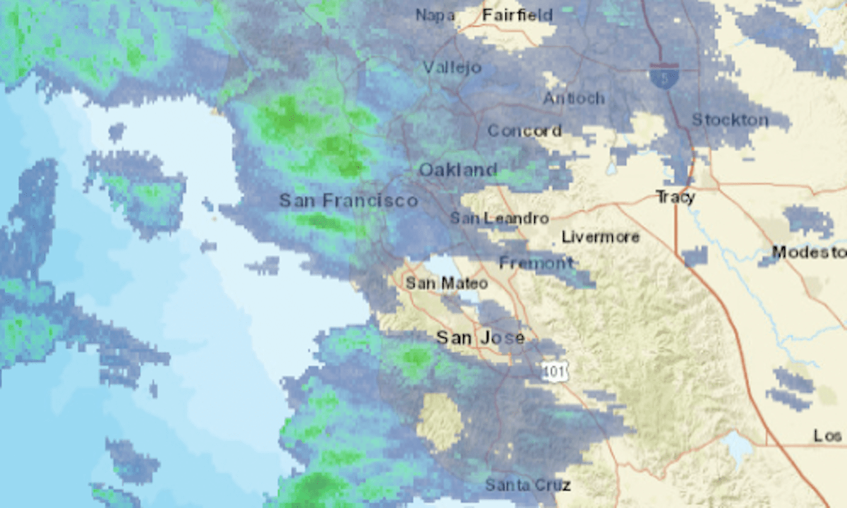
The updating radar map above shows areas of precipitation in green, with greater intensities indicated by yellow and orange.
The heaviest rainfall is expected Sunday and Monday. In the Sierra Nevada, the weather service has issued a winter storm watch from late Friday to late Monday, with 1 to 3 feet of snow expected above 7,000 feet elevation.
Updates on road closures and chain controls in the Sierra Nevada can be found on CalTrans’ website or mobile app or by calling (800) 427-7623.


+ There are no comments
Add yours