


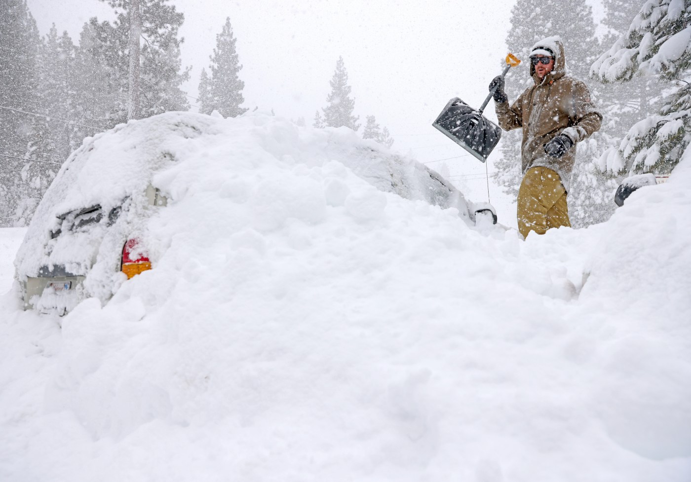
Interstate 80 remained closed through the Sierra Nevada on Monday morning after a punishing blizzard that dropped several feet of snow across the Lake Tahoe region, cutting off travel between the popular tourist spot and much of the rest of the state.
A blizzard warning for the northern Sierra expired shortly before 12:30 a.m. Monday, and was replaced by the National Weather Service with a winter storm warning as the threat of snow continued to hound the region. Another 4 to 10 inches of powder was expected to fall over Donner Pass between Monday morning and early Wednesday morning, according to Dakari Anderson, a National Weather Service meteorologist.
“We’re on the downtrend of things,” Anderson said. “Hopefully they will be able to get out there and really start to dig out of the snow.”
The storm system that swung into California from the Gulf of Alaska late last week marked the biggest dumping of snow for the Sierra Nevada this season, with remarkable totals at ski resorts across the Lake Tahoe region.
Sugarbowl Summit received 10.5 feet of snow over the last four days, while Palisades Tahoe received nearly 8 feet of snow, Anderson said. Kirkwood, near Carson Pass on the southern side of Lake Tahoe, received nearly 5 feet of snow, he said.
Further west, cloudy skies and light showers were expected to linger through Wednesday for much of the Bay Area.
Related Articles
Marin County waterfalls flush as rain keeps coming
Photos: Stranded Bay Area travelers make the best of the Tahoe blizzard as Interstate 80 remains closed
Persistent Sierra blizzard forces Bay Area visitors into a waiting game
Tornado warning issued for Santa Cruz, San Benito counties
Photos: Strongest blizzard of the year dumps 24-42 inches of snow in the Sierra Nevada
Little in the way of measurable precipitation is expected in that time, with rainfall totals expected to be in the hundredths of inches through Wednesday, Nicole Sarment, a National Weather Service meteorologist.
“There may be pockets of sunshine, but it’ll still be cloudy,” Sarment said. “Hate to be the bearer of bad news.”
Rainfall over the weekend continued to add to impressive precipitation totals for much of the Bay Area so far this year, with the San Jose airport receiving about .5 inches of rain since Friday morning, while downtown San Francisco received 1.66 inches of rain. The Oakland airport received 1.15 inches of rain in that time.
Mostly sunny skies should return Thursday and Friday, Sarment said, before another round of rain returns over the weekend. Temperatures should linger in the low 60s for much of the week for the majority of the Bay Area.


+ There are no comments
Add yours