


On Tuesday, the fourth day of dry, windy weather across much of California, 11 wildfires of more than 300 acres were burning in the state — and two were more than 15,000 acres.
Related Articles
California on fire: Wind, sun, dry conditions blamed for blazes around the state
Map: Air advisory for Bay Area goes out as smoke from Point, Sites fires sends haze
Aero Fire map: Evacuation ordered as wildfire nears Copperopolis
Map: Wildfires burning across California; crews make gains against Point Fire
Wineries on high alert as Point Fire burns in Sonoma County
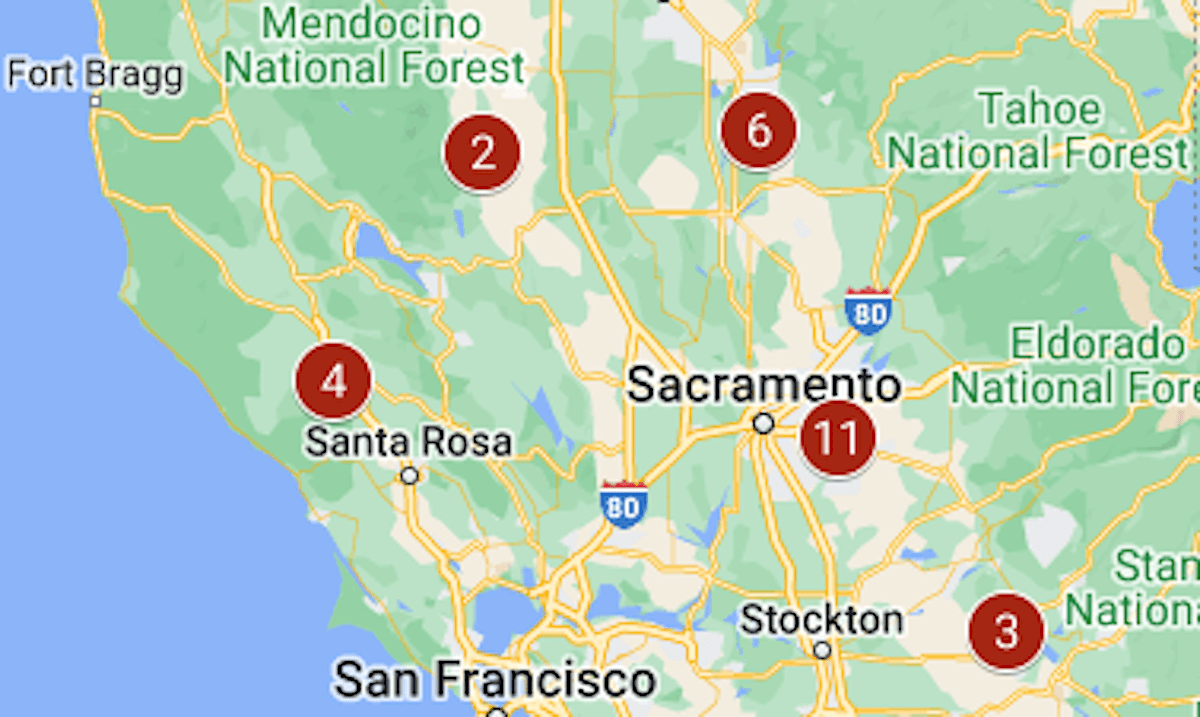
The map above shows the location of the largest fires that were burning at the start of Tuesday; by the evening, three were completely contained.
Below are the latest figures from the California Department of Forestry and Fire Protection:
1/ Post, started June 15; 15,690 acres, 31% contained
2/ Sites, started June 17; 15,565 acres, 5% contained
3/ Aero, started June 17; 5,425 acres, 23% contained
4/ Point, started June 16; 1,207 acres, 50% contained
5/ Hesperia, started June 15; 1,078 acres, 91% contained
6/ Junes, started June 15; 1,056 acres, 100% contained
7/ Lisa, started June 16; 890 acres, 100% contained
8/ Hernandez, started June 15; 642 acres, 80% contained
9/ Tuscany, started June 17; 350 acres, 90% contained
10/ Max, started June 16; 338 acres, 100% contained
11/ Douglas, started June 17; 327 acres, 0% contained


+ There are no comments
Add yours