


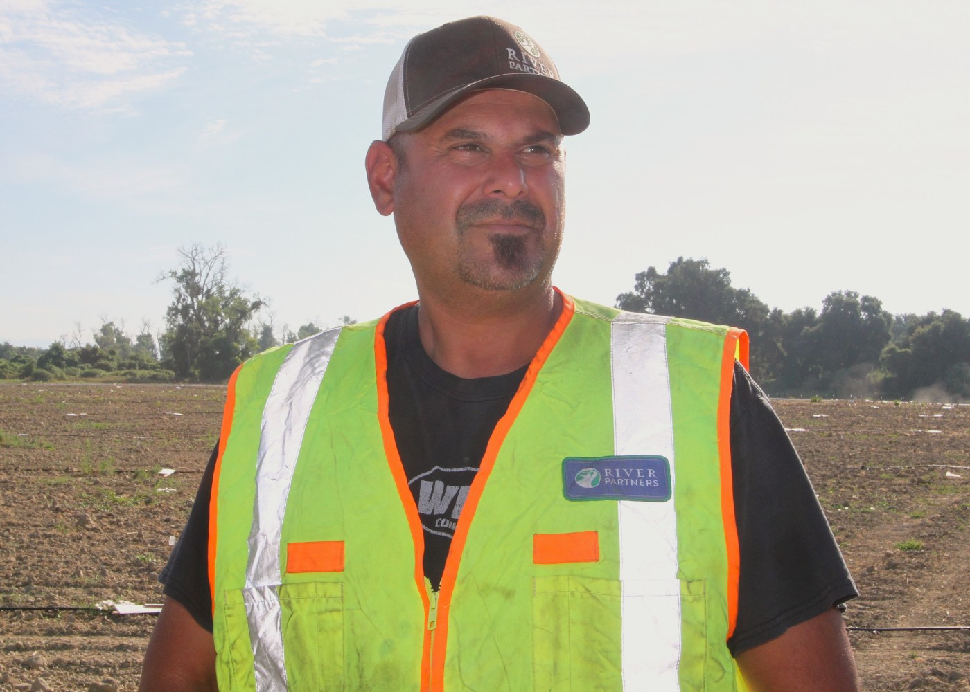
HAMILTON CITY — Chris Carrizales has deep roots in Hamilton City. He’s faced the wrenching decision of whether to evacuate when the Sacramento River has overflown into his community — not once, but several times. He’s served on the board of the Hamilton City Fire Protection District and remains a board member for the Hamilton City Community Services District.
The past few years, he’s been laying down new roots — literally. As the Sacramento Valley field foreman for River Partners, a Chico-based nonprofit that performs habitat restoration work across the state, Carrizales has supervised plantings constituting an environmental aspect of the levee project in his town.
This endeavor, formally called the Hamilton City Combined Ecosystem Restoration and Flood Damage Reduction Project, has resulted in a 6.8-mile setback levee and hundreds of acres of native habitat. It’s brought together a variety of agencies — federal, state and nongovernmental — in an unprecedented way with the potential to set precedents for future projects.
“It’s good to be a part of it, being that I was one of the first ones who started the first half of it,” Carrizales said during a recent tour of the site. “Very exciting. A couple bumps here and there, but what job doesn’t have bumps?”
For the better part of three decades, hopes to replace the failing J Levee languished because of a cost-benefit formula used to allocate funding: a ratio greater than 1:1 between the value of property protected and the project’s price tag. Then, the U.S. Army Corps of Engineers (USACE) added natural resources to the benefits side of the equation, and with conservation as part of the construction, the figures penciled out.
River Partners began its work in 2016, and USACE built the setback levee in 2021, when the first phase of habitat restoration also finished. The second phase, which wrapped up Friday, brings the total to 1,387 acres replanted. The levee reconnected 1,480 acres of floodplain to the Sacramento River, and the project as a whole connects 4,000 acres of riparian lands.
It cost $93 million and brought together River Partners and USACE with partners including Reclamation District 2140, the California Department of Water Resources and the Nature Conservancy.
“This project is such a beautiful illustration of a public-private partnership — local, state and federal government agencies working together,” River Partners president Julie Rentner said. “It’s really cool.
“It was literally decades of work to get this up and running and funding and entitled. Getting to the point where the first phase could be implemented, that was huge.”
Benefits
Need for a new levee has long been evident. Hamilton City residents have evacuated six times since the 1980s, with seasonal flooding and high-water events commonplace. Meanwhile, as agriculture transformed swaths of natural habitat, flow patterns changed.
Impacts affected non-human denizens, too. Those are harder to quantify in dollars and cents, but not impossible. Therein lay the breakthrough.
“A project needs to prevent more flood damage than it costs to implement,” explained James Lee, project engineer with USACE. “And for rural communities where damages aren’t as high (relative to cost), it’s very, very difficult to provide levee projects to address flood needs in those areas.
“In this project, the levee was set back, and a portion of the cost of building that setback levee was attributed to ecosystem restoration. We don’t calculate dollar amounts of ecosystem benefits, but we do try to use models of habitat that would be able to quantify habitat benefits.”
The first phase took place mostly out of public view, as its location east of Highway 45 is shielded from the road. The second phase, which leapfrogs the Irvine Finch River Access area, is visible north of well-traveled Highway 32.
River Partners just completed planting 67,000 native trees and vegetation on 465 acres. Before that, crews laid 82 miles of irrigation lines connected to a water pump. After three years, River Partners will remove — and recycle — the drip-irrigation system, and the foliage will be on its own.
That’s the situation at phase one, where 922 acres rely on mother nature. Elderberry trees remain hardy, their branches filled with bunches of ripening fruit, and the lush terrain contrasts with the bare-bones appearance of phase 2.
“Same as with phase one, we’ll be caring for those plants for three growing seasons, and then we’ll turn off the water,” Rentner said. “That’s essentially when the really exciting stuff happens in restoration projects: You turn off the water and stop tending to the trees, and you see which ones have grown root mass large enough to reach permanent water — and they’ll remain vibrant and robust and grow really quickly — and then some that are maybe in sandier, droughtier soils that won’t grow as robustly.
“All of that sorting out that nature does on its own creates a mosaic of habitat, so instead of just a consistent blanket of the planting pattern that you see when we first set out, the whole thing becomes a very rich, very diverse landscape.”
Views
Figuratively as well as literally, the project is growing on Hamilton City. Both Carrizales and field manager Josh Waddell — another worker in the early days, as an intern out of Chico State — have seen doubts give way to appreciation of the levee and restoration.
“I used to get a lot of kickback from a lot of locals,” Carrizales said. “I want people to understand what we’re doing. We’re not doing it to upset people; we’re doing this to benefit people. I think slowly it’s coming around, because I don’t get that feedback.”
Added Waddell: “Farmers thought we were taking their land out of production to never be used again. Now they’ve realized they need more water — they’re having issues with their wells — and they’re seeing benefits of us restoring land just inside the levee, areas that were hard to insure and high risk to farm due to flooding.”
Even more than growers, Carrizales heard from hunters. The bulk of the project area is off limits to the public, at least at this juncture, so recreational activities are constrained.
Related Articles
Desalination plant proposed for San Francisco Bay
Wildlife sleuths use DNA to understand deadly attacks in Santa Cruz Mountains
Honey Run Bridge uncovered: wood beams mark milestone in Camp Fire recovery
Rare butterfly is behind ‘mass destruction’ on rare Miami plants. Can both be protected?
Oroville initiates step toward public energy
“I think a lot of them have forgotten what it was like before it became farmland,” he said. “We’re trying to bring it back and make it better. Over the years, animals have depreciated. When you see deer and birds coming back, we know what we’re doing is working, for sure.”
For that, not just the restoration zone recovers. These sites, in conjunction with others along the river, have a ripple effect.
“Our projects are mainly focused all along the Feather (River) and Sac River,” Waddell said, “and you can see how wide the channel is all the way from Redding, and as you get closer to Colusa, the river gets tighter and more combined. So anything we do to widen the flood capability on each side, it makes the wildlife and everything better.”


+ There are no comments
Add yours