


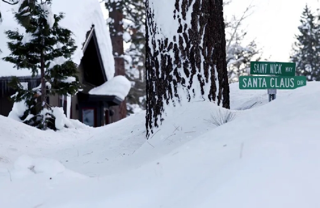
A powerful winter storm that is expected to bring blizzard and white-out conditions to the Sierra Nevada, as well as at least 1½ inches of rain to much of the Bay Area moved steadily toward the region Thursday morning and was on track to make an impact by the afternoon, according to the National Weather Service.
“We’re already beginning to see a small bit of rain in the North Bay,” meteorologist Dalton Behringer said early Thursday. “It’s really light and scattered stuff here and there. The heavier stuff should be here by the afternoon.”
Related Articles
Biggest storm of the year to bring up to 10 feet of snow and “near to impossible” travel conditions to Sierra this week
Bay Area sunshine can’t last forever. We’re headed for a cold, rainy week
Hurricane Hilary was not a tropical storm when it entered California, yet it had the same impact, study shows
Alameda County: Niles Canyon Road partially reopens after collapse during storm
What does California’s rainy season mean for water supply?
A blizzard warning issued Tuesday for the Northern and Central Sierra Nevada went into effect at 4 a.m. Thursday and will last until 10 a.m. Sunday. The warning affects Lassen and Shasta counties, as well as Lake Tahoe to Tuolumne and Mono counties near Yosemite National Park.
Weather forecasters expect at least 5 to 12 feet of snow to fall above 5,000 feet. Authorities urged anyone not already in the mountains not to go and said roads and highways are likely to be shut down.
PG&E in a statement said it was pre-staging crews and materials to tackle power outages that the storm may bring and that they are prepared to use helicopters, snow cats and four-wheel drive to gain access to areas that need repair. Still, they said customers in remote areas “should prepare for extended outages give the unique circumstances of this storm.”
In the Bay Area, the system is expected to bring several rounds of heavy rain showers, according to Behringer. The heaviest rain is expected to fall in the North Bay and in the coastal ranges.
“Thursday will be the main band of it,” Behringer said. “After it goes through, we will have scattered showers into Friday. Then on Friday, we’re going to get another heavier push.”
The storms have been generated by a large low-pressure system that’s descending from the Gulf of Alaska and bringing cold air with it. Low temperatures are expected to dip daily until they go into the 30s in most places in the East Bay by Saturday night into Sunday morning.
Temperatures are expected to bottom out in the low 40s in San Jose.
The storm also is expected to bring wind gusts that could get as high as 40 mph. A high-surf advisory also is likely, according to the weather service.


+ There are no comments
Add yours